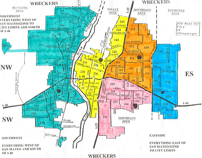
This is a direct scan of the beat map I used when I was a police dispatcher. Actually, it is a wrecker map used to determine which wrecker company to call when a unit requests a tow, but I didn't have a regular beat map at the time, so I just colored this in and used it. The regular beat map is exactly the same except it has the address and phone numbers of all the substations around the city on it. Albuquerque is divided into five sectors or area commands. They are:
Westside or sector 10 which is the green colored area
Valley or sector 20 which is the yellow colored area
Southeast or sector 30 which is the pink colored area
Northeast or sector 40 which is the orange colored area
Foothills or sector 50 which is the blue colored area
The black dots in each area command are the location of that area commands substation.
The parts of the city not covered by APD are the territory of the Bernalillo County Sheriff's Department except in the area south of the Southeast Area Command which is Albuquerque Airport Police and Kirtland AFB.
The call signs for APD have changed to be more standard and after a little learning, easier to figure out. I don't have my cheat sheet handy right now so won't be putting them up for now.
Click back to go back to main page.